Adamawa State Government Official Website​

History

A Brief History of Adamawa State

Location of Adamawa State in Nigeria- Original work:Uwe Dedering

Adamawa State, also known as the Land of Beauty, was established on August 27, 1991, alongside Taraba State, emerging from the former Gongola State with Yola as its capital.

Situated in the North-East of Nigeria, it covers a substantial land area of 36,917 square kilometers, ranking as the 8th largest state in Nigeria, just behind Zamfara at 7th. The state shares borders with Borno State to the Northwest, Gombe State to the West, and Taraba State to the Southwest, while also having international borders with Cameroon to the East. Adamawa State is divided into 3 senatorial districts, 8 federal constituencies, and 21 local government areas.

Population:

In the 2006 National Population Census, Adamawa was ranked 26th in Nigeria, with a population of 3,178,950, consisting of 1,561,978 females and 1,606,101 males. Its projected population is estimated to be 4,902,100 as of 2021.

Climate and Weather:

Adamawa experiences a tropical climate characterized by two seasons: the dry season (October to April) and the rainy season (May to September). The average annual rainfall is 79mm in the northern regions, particularly around Michika and Madagali, and 179mm in the southern regions, around Ganye and Toungo. Weather conditions include moderate to extremely cold weather during the Harmattan, accompanied by dusty winds from the Sahara (September to February), and extremely hot weather (March to April). Average temperatures range from 15.2°C in some regions during Harmattan to 43°C in others during hot weather.

RT. Hon. Ahmadu Umaru Fintiri CON

Executive Governor

Adamawa State

Prior to its establishment as a state in Nigeria, Adamawa existed as a subordinate kingdom within the Sultanate of Sokoto, encompassing a significant portion of northern Cameroon as well. The rulers of Adamawa held the title of emir, referred to as "lamido" in the local Fulfulde language.

Vegetation

There are two distinct vegetation zones in the State: the Sub-Sudan zone and the Northern Guinea Savannah zone. The Sub-Sudan zone is characterized by dense forests, tall trees, and tall grasses, primarily located in the southern part of the State, especially in temperate areas such as the Banga plateau of Mayo-belwa Local Government Area, as well as some villages in Ganye and Toungo Local Government Areas. The residents cultivate cash crops, including cotton, cowpea, Bambara nuts, tomatoes, onions, pepper, and sugarcane. Additionally, the State yields various fruits such as pawpaw, guava, cashew, mango, banana, and orange.

Population

Population: In the 2006 National Population Census, Adamawa was ranked 26th in Nigeria, with a population of 3,178,950, consisting of 1,561,978 females and 1,606,101 males. Its projected population is estimated to be 4,902,100 as of 2021.

Occupation

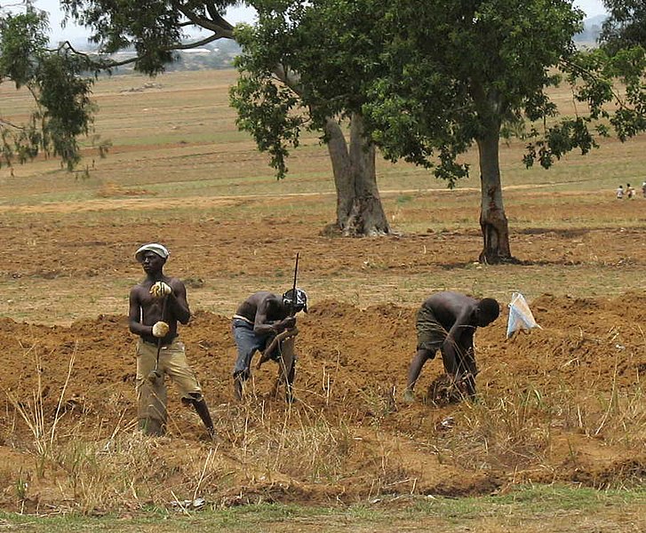
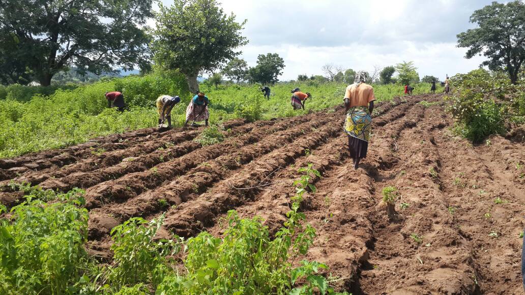
The primary occupation for the majority of the population in Adamawa State is agriculture. They cultivate a variety of crops such as Groundnut, Cotton, Maize, Yam, Cassava, Guinea Corn, Millet, Beans, Sweet Potato, and Rice. Cattle rearing is also a significant occupation, and communities residing along the banks of River Gongola and Benue are engaged in fishing. During the dry season, these communities utilize wash bore and tube well irrigation, along with water pumps, for the production of vegetable crops like tomato, onion, pepper, amaranthus, okra, garden egg, and melon. The abundance of these Fadama crops during the dry season contributes to the state's status as a major producer, with surplus produce often transported to neighboring states.

Contact Us

Adamawa State Government House, Dougirei, Yola, Adamawa State Nigeria

Mon – Fri: 8:00 am – 6:00 pm

Adamawa State Government © 2023. All Rights Reserved